
Shannon has been talking about the “Boundary Waters” for a few years and I’d never heard of it! As he started to tell me about it, I thought it sounded pretty great! We finally got to go into the BWCA the first week of June, and we floated, camped and fished for 8 glorious days and had a blast!
Boundary Waters Canoe Area Wilderness – from the site linked there ” Established in 1964 as Federally Designated Wilderness (pdf), the Boundary Waters Canoe Area Wilderness is over one million acres of rugged and remote boreal forest in the northern third of the Superior National Forest in northeastern Minnesota.The BWCAW extends nearly 150 miles along the International Boundary, adjacent to Canada’s Quetico and La Verendrye Provincial Parks, is bordered on the west by Voyageurs National Park, and by Grand Portage National Monument to the east. The BWCAW contains over 1,200 miles of canoe routes, 12 hiking trails and 2,000 designated campsites. The BWCAW is composed of lakes, islands, rocky outcrops and forest.“
Planning for this trip was no small event. Shannon had to start thinking last fall about when we may want to go, as the Permit lottery opens on Jan 31- and you must get into the site and secure the date and the entry point you want. It was a big day when we found out we got the date and spot we hoped for!
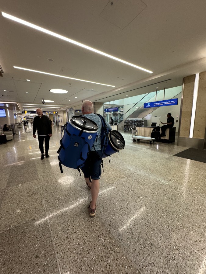
We have a lot of camping and Canoeing gear, but we did have to get a few things extra for this trip. first, were the blue barrels you see above in the boat. We loaded them down with all of our camping and cooking gear, and checked them on the airplane as baggage.
- Side note – When we arrived at the Minneapolis-St Paul airport, the baggage claim attendant said she’d had to google to see what they were! We’d expected to see lots of these in the airport with so many in the BWCA in the summer, but we learned later that many people rent all supplies and buy all food pre-packaged from the outfitters. We took all of our own food (dehydrated meals and some perishables we got at Wal-Mart on the way to the outfitter), all of our own fishing equipment, and all of our camping gear. The only thing we got from the outfitter, were canoes, paddles, and PFD’s.
From the Minneapolis St Paul airport, it is about a 5.5 hour drive. You go through Duluth, and along Lake Superior and into the resort town of Grand Marais. From there, you head north onto the Gunflint Trail

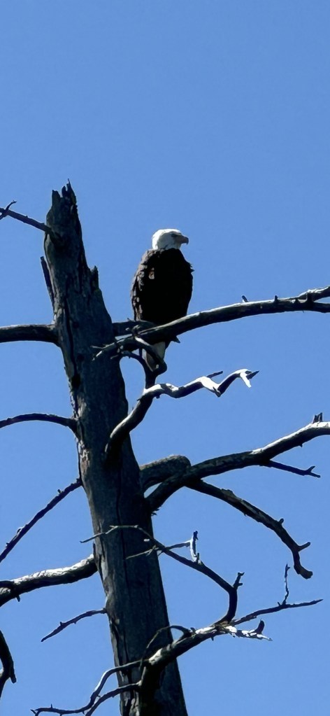
The Gunflint Trail National Scenic Byway – from the site linked there ” The Gunflint Trail is a northeastern Minnesota destination of a different nature, where moose, loons, warblers, Goshawks, and Boreal Owls out-number the human population. The north woods and boundary water lakes are full of exciting things to do spring, summer, fall, and winter (and remember, we get a LOT of snow here!)”. We had hoped to see a moose, but instead, saw a grouse and a beaver!
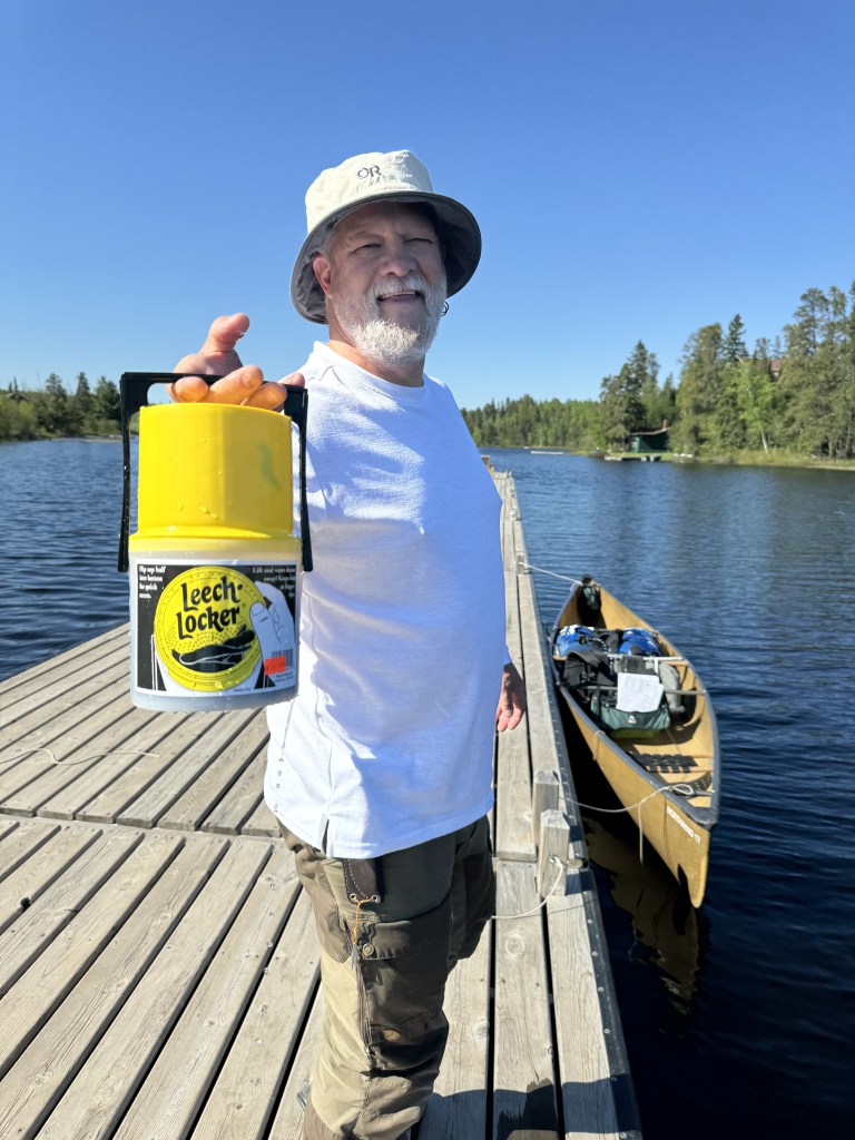
We used Seagull Outfitters and can’t recommend them highly enough.


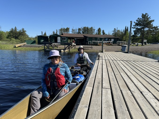
The outfitter does have a bath house with showers, and ours also provided towels to use which was huge! As we knew it would be our last for a week, we took advantage of those. Come to find out, it seemed that most other people use them when they come out, instead of before going in- but nevertheless we did. We paddled right out from the outfitter on Seagull Lake, and headed across to our first portage into Alpine Lake.


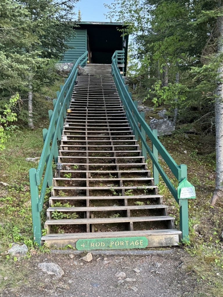
In between most of the lakes in the BWCA, are small portages that must be traversed. The portages are measured in “rods” . From Wikipedia – ” The rod, perch, or pole (sometimes also lug) is a surveyor’s tool[1] and unit of length of various historical definitions. In British imperial and US customary units it is defined as 16+1⁄2 feet, equal to exactly 1⁄320 of a mile, or 5+1⁄2 yards (a quarter of a surveyor’s chain), and is exactly 5.0292 meters.”
Shannon had worked hard to make our portages do-able for the 2 of us. For each portage we’d each need to make 2 trips with the gear. He’d bought backpack-type straps for both of our blue barrels, and in addition to that, we had one large dry bag + 2 bear canisters full of our food strapped onto a backpack frame, plus the canoe. The way it ended up working out is that I portaged both blue barrels separately, and Shannon portaged the heavier dry bag/food and the canoe. I don’t know how to express how expertly he managed to organize us for it – but it was quite the feat. So as I said, the first portage was on the first day from Seagull Lake to Alpine Lake. Here are a couple of quick videos of that (that cannot be viewed in email – only can be played on the website)
It wasn’t easy, but it wasn’t terrible either. Yes, it was heavy to carry equipment, muddy in spots, boggy, and lots of mosquitos – but it was worth it for the experience!

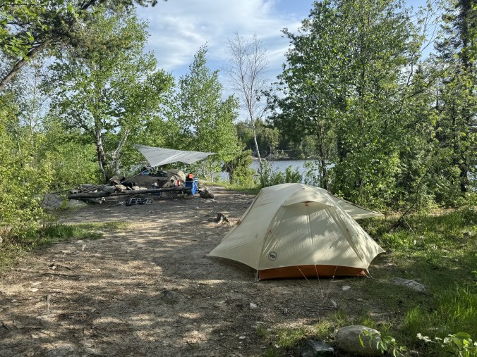
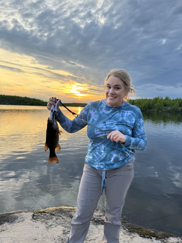
When we got into Alpine Lake, several hours after leaving, we decided to go ahead and set up camp and enjoy some fishing! We had a great time camping and fishing on Alpine Lake and it was one of our favorite campsites!! I took notes every day in my phone to help me remember details, and here’s what I wrote about that first night: ” Set up camp on Alpine Lake site #351. Paddled 6.5 miles total. Gumbo and ice cream sandwiches for dinner – then fishing. Bed before dark – tired!” Shannon used a paper map and a compass to navigate our route, however, he also had several maps downloaded with our route into his phone. One of the sites had the campsite number listed which is how we knew which ones we were in, but the site number is also written on the fire grates and on the toilets at each site.


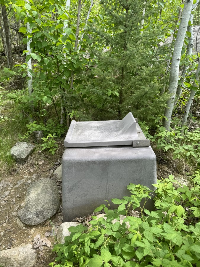
Speaking of the toilets, the ones in the BWCA are interesting, in that they’re set down a path at each campsite, in the woods. It took some getting used to as they are out in the open with no walls – just a seat over a hole in the ground. Here in Alabama, there’d be a huge concern about snakes inside of them, but as the weather up here is a good bit cooler, the only pests around the toilets that we found were bugs.
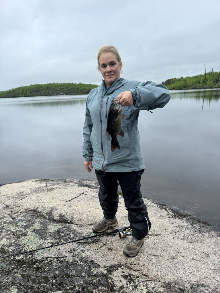
As I mentioned, we woke the next day to rain. We were prepared for rain and suited up in our rain gear and carried on. We were tempted to spend another night in this spot, but ultimately decided to go ahead and travel. We started the day with more fishing before we headed out, and we fished along the way.

From my phone notes: ” Pack up and leave Alpine, and paddle/portage to Jasper lake, Jasper to Kingfisher Lake, and Kingfisher to Ogishmuncie. Campsite #790. Paddle total 5miles. Chicken pot pie and rocky road pudding for dinner”
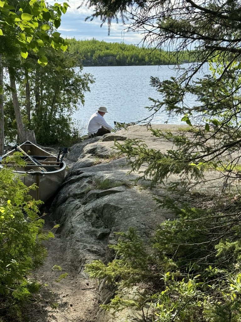
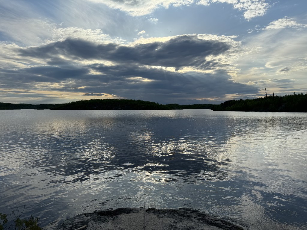
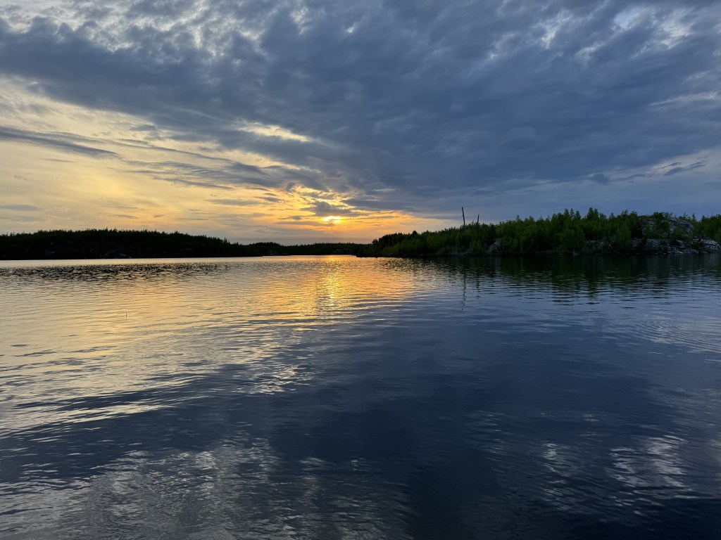
The weather cleared up nicely for us when we got to “Ogish” as the locals call it. We had a fun night fishing and watching a gorgeous sunset


The next morning, we set out knowing we’d have more than a few portages between several small lakes. From the notes in my phone:
“Tuesday – Day 3 – Breakfast Skillet and hot chocolate. Paddle Ogish /portage to Annie Lake. Paddle to portage to Jenny Lake. Paddle to portage to Eddy lake. Paddle to portage to South Arm Knife Lake. Paddle through white caps and high winds and ran for campsite. Found #1434 on South Arm Knife. No fire – too wet from rain. No fish today. Paddle 6.9 miles total. Homestyle chicken noodle and mint ice cream sandwich for dinner. ”


The next morning we woke to rain, but it cleared out by about 9am as we got ready to paddle into Canadian territory! I’ll tell you all about that in part 2!!

Pingback: Boundary Waters Canoe Area Wilderness (BWCA) – Part 2 | Heads East, Tails West
I’d love to explore the Boundary Waters Canoe Area Wilderness someday. We’ve been to Quetico before and it’s such a lovely area. We’ve flown with our camping gear many times, but I’ve never thought to take a blue barrel with us! But hey, this meant you could pack more of your own gear and food with you. Even though you’ve gotten some rain, it looks like you’re off to a great start for your trip. Love the sunset pictures. Those types of open toilets (we call them thunderboxes) are common in the backcountry in Ontario. They can be awful when the bugs are bad!
LikeLike
i knew I’d seen you post about Quetico before- and knew that was why it sounded familiar to me. You must go! We are considering Canada for next year- and thankful for all the resources you have for me at the ready!! It is so beautiful up here! Glad to know the thunderbox term 😂-Michelle
LikeLike
Nice! There’s no shortage of beautiful scenery and outdoor adventures up here in Canada. We’re actually thinking of heading back out west later in the fall to either California, Texas and/or New Mexico.
LikeLiked by 1 person
All good choices!!!! Santa Fe, Sedona,- are favorites. So are redwood forest and San Francisco Bay Area!!
LikeLike
What an adventure! Thanks for sharing through your blog.
LikeLiked by 1 person
Love this story! So cool when your transportation, other than walking, is a canoe! I learned a new word cause had no idea what “portage,” was. Now I do. 🙂 Great pics too! What a sunset!
LikeLiked by 1 person