We don’t see a lot of snow in Alabama, and for that reason it’s a bit of a novelty. Last February, when there hadn’t been any snowfall yet in the Alabama winter season, Shannon suggested that we go and find some. Snow had fallen in North Carolina in the week prior, and the weather report looked promising for it to stick around for awhile. He’d been up to North Carolina to trout fish with his dad years ago, and had been down the Nantahala river in a raft a few times, and therefore was familiar with the area that held the snow. We left Alabama in the early afternoon, and traveled through North Georgia, and on into North Carolina, mostly on backroads that wound through the country.
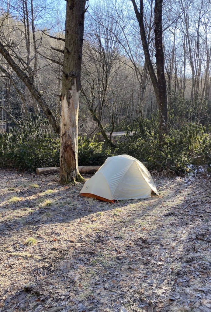
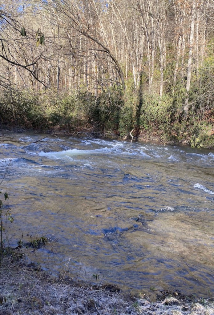
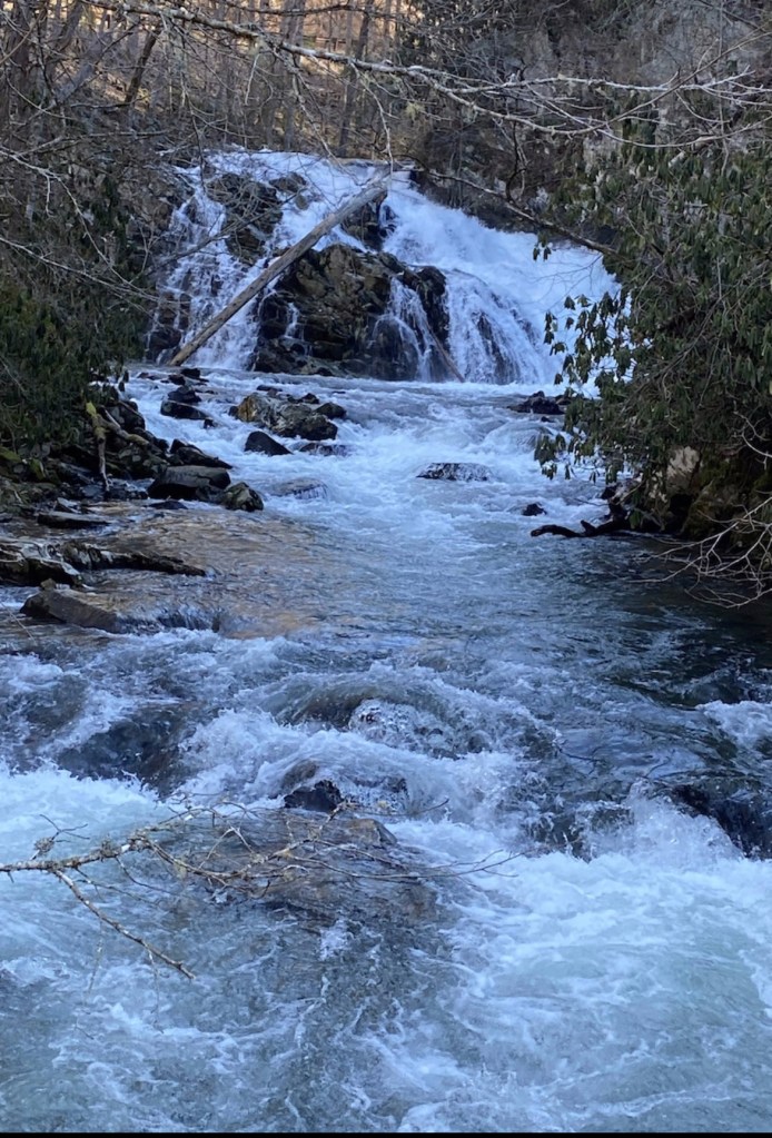
After a stop in North Georgia for Mexican food, we arrived at our destination. It was off of Wayah Road near Franklin, North Carolina, and was quite a ways off the beaten path. Although the area is frequented by fishermen, it’s mostly un-marked in any meaningful way (Or maybe I missed the signs in the dark). As soon as we stepped out of the car, I was overtaken with the beauty of the night sky, unpolluted by any city lights. We could hear the sound of the little Nantahala rushing in the distance as we set up camp.
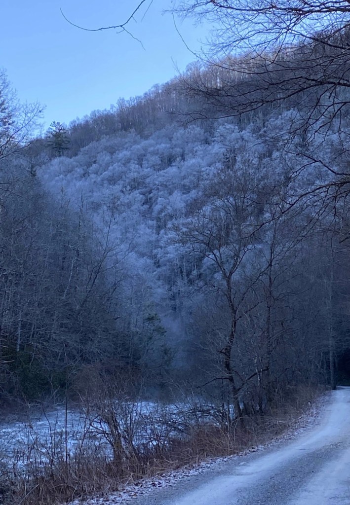
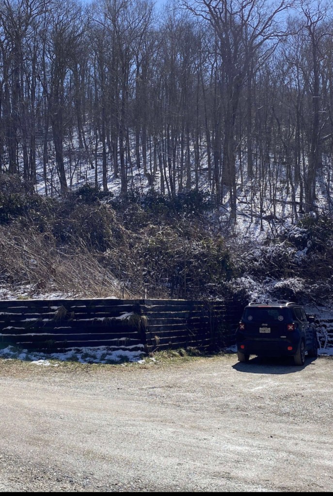
I was very excited to see the snow that had fallen overnight as we woke to a beautiful morning. Shannon, as always, was presenting me with endless options for where to hike that day, and I, as always, kept deferring to his good judgement. We headed down to the Nantahala Outdoor center to pick up a few odds and ends, and then made our way to the trailhead for Tellico Gap. We’d decided to hike part of the Appalachian National Scenic Trail and to spend the night in the Cold Springs Shelter. Right as we pulled up into the parking lot, a bald eagle sailed over us. It was the first one I’d ever seen in the wild and I was ecstatic!
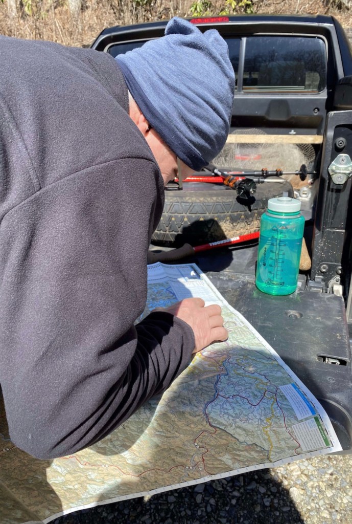
- Side note – We had been talking about going to the Pacific Northwest to do a serious hiking trip on one of the mountains in Oregon or Washington State. We loosely referred to this hike as “practice” and therefore decided to treat this as training for a more difficult hike.
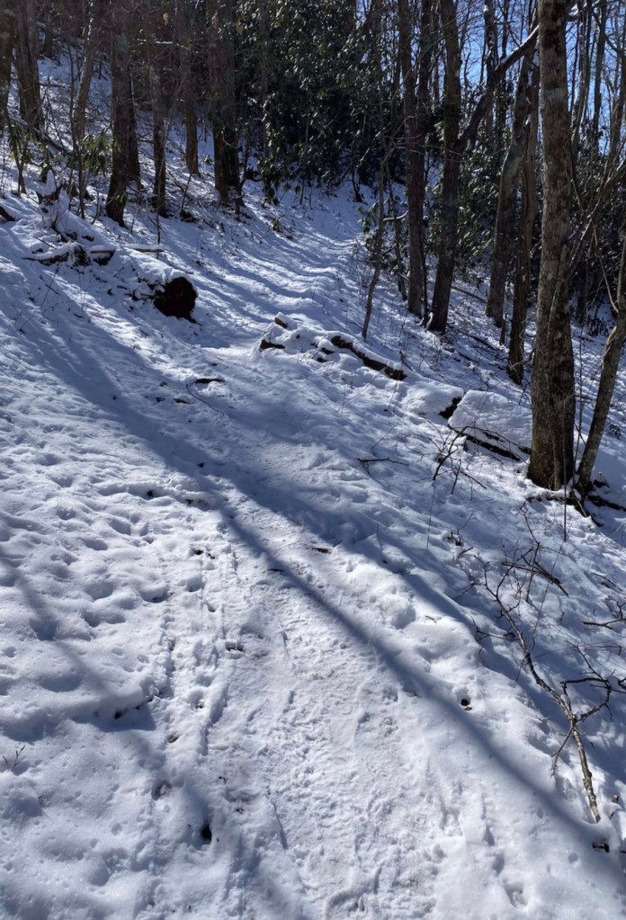
As we ascended the trail from the trailhead, loaded with backpacks full of camping gear, food and water, I quickly realized that whatever cardio workouts I’d been doing had little prepared me for where I was. Hiking, strait up a steep hill for well over a mile in the snow. There’s no way to say it other than it was really hard. I say all the time that I don’t mind hard. We just took it slowly, at our own pace, and one step at a time. We also stopped a lot for breaks.
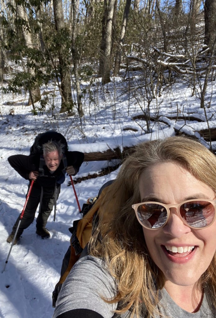
That photo above is deceiving. Shannon was practically running up the mountain as I slugged along behind. I kept having to tell him to go on ahead and I’d catch up. He’d get a ways ahead and stop to breathe and I’d eventually catch up to him and we’d resume. After about an hour and a half of this, we reached Rocky Bald. It was an outstanding spot for a rest stop and a cup of coffee.
After our break, we carried on up the mountain and eventually reached the shelter. It was early afternoon, around 3pm when we got there, and we were glad to still have a couple of daylight hours left. There was a sign about 50 feet from the shelter that read “3.4 miles”. If you’d have asked me how far I thought it was I would have said 8 miles. I’m guessing that was largely due to the steep incline in the snow. It was a beautiful hike though, and we were in the snow!
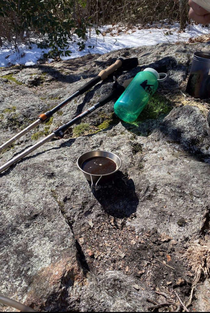
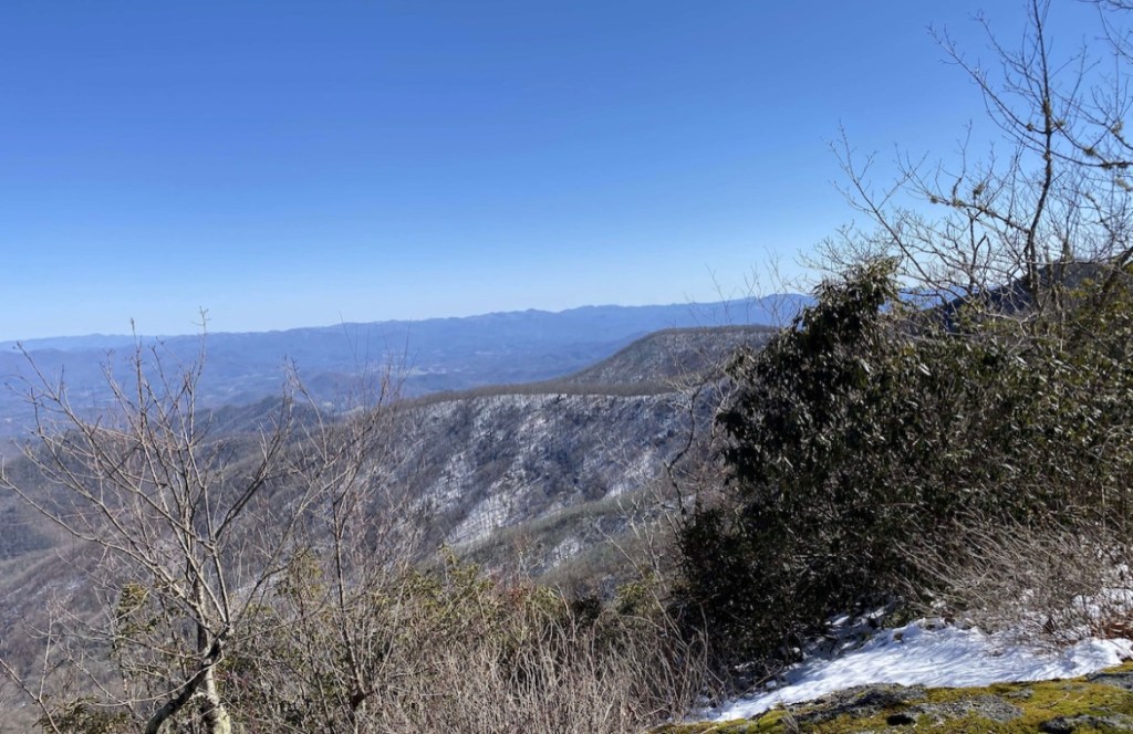
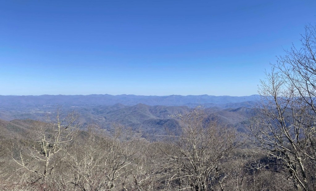
We boiled water for our hiking meals, and ate them at the very top of the ridge above the shelter, which had an incredible view. Just as the sun was setting, and the temperature started dropping, we decided to go ahead and burrow ourselves into the down sleeping bags with all 20 sets of hot hands hand warmers we’d brought for this trip packed all around us.
We managed to stay warm through the night and woke up early, feeling well rested. The freezing overnight temperatures had re-frozen the snow, so the hike down began more like a slip and slide, which of course I thought was great fun.
Hiking down took far less time and we reached the car in a little over an hour. We loaded up the gear and headed strait to the huddle house for a big breakfast and hot coffee! It was a fun weekend, and a beautiful hike!

The forest looks magical covered in snow. Hiking in the winter can definitely be more challenging and slippery! I don’t mind the downhills too much when there’s snow as I’ll just try to slide down the steep parts on my but. I love that you put all your hand warmers in your sleeping bag. What a great idea!
LikeLiked by 1 person
It was so pretty! And the irony of my declaration that snow is a novelty here ….. and it snowed here yesterday 😂. The hand warmers were literally making a layer between us and the cold boards of the shelter! Also had them inside socks and gloves. They kept us comfortable!!
LikeLiked by 1 person
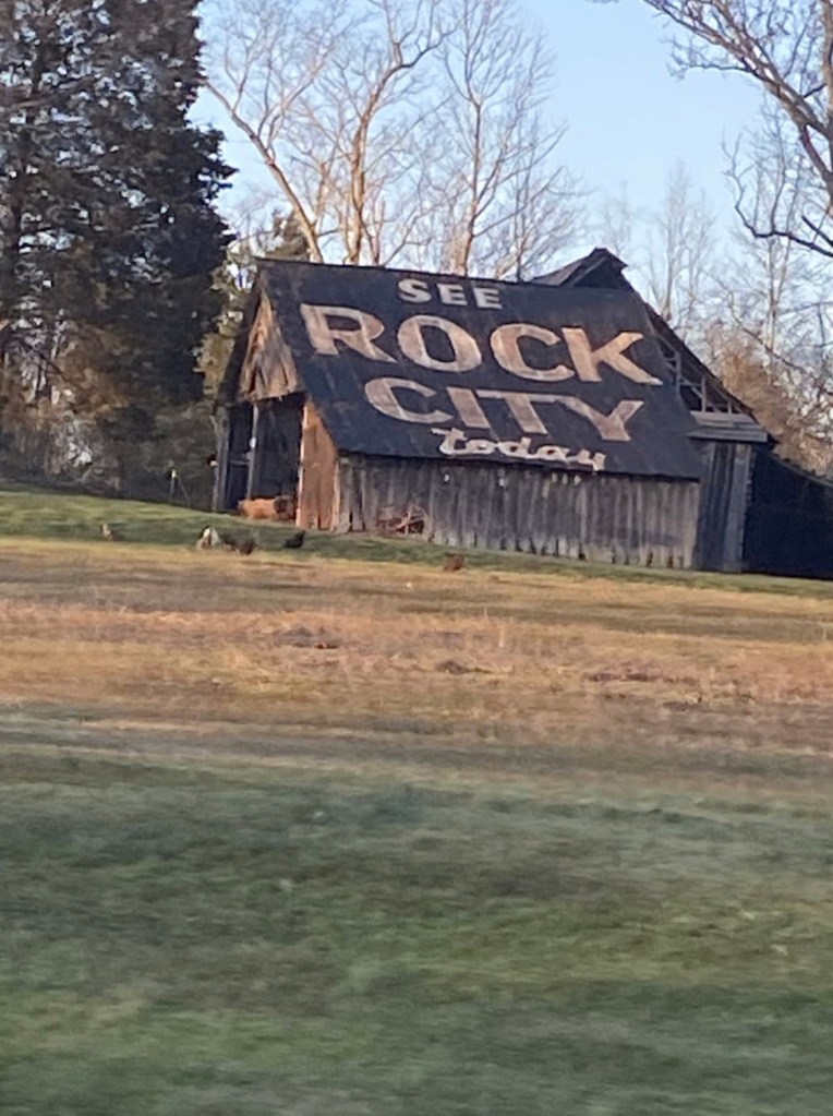
very interesting. great writing and I love the photography. I have a Christmas tree or nament of Rock City just like that picture. I enjoyed your blog.
LikeLiked by 1 person
I think we should go back one weekend soon! Good exercise for you and Popps 🙂
LikeLike
Looks like you had some very nice time. Very nice to see the snow on the trail too!
Thanks for sharing this post and greetings from Greece!
LikeLiked by 1 person
Thank you so much! It was a lot of fun!
LikeLike