Imagine, if you will, that you’ve just come back to your parked car from an 8 mile hike in the snow. You’re sweating and frozen, tired but exhilarated! You eat some nearly frozen fried chicken and an energy bar while you wait for the car to warm up. You’re 25-30 miles inside the Labyrinth Canyon wilderness, and still have 3-4 hours of daylight left.
This was when Shannon looked at me and asked if i was ready to go ahead to Colonnade arch. It was a little bit of a drive from where we sat, and once we reached the trailhead – about a 3 mile hike. I said, “ yes!” He looked over at me again, and said,“ you sure? It ain’t no place for a girl”. He knows that anything he defines in these terms riles me up. Nothing could keep me from it now.
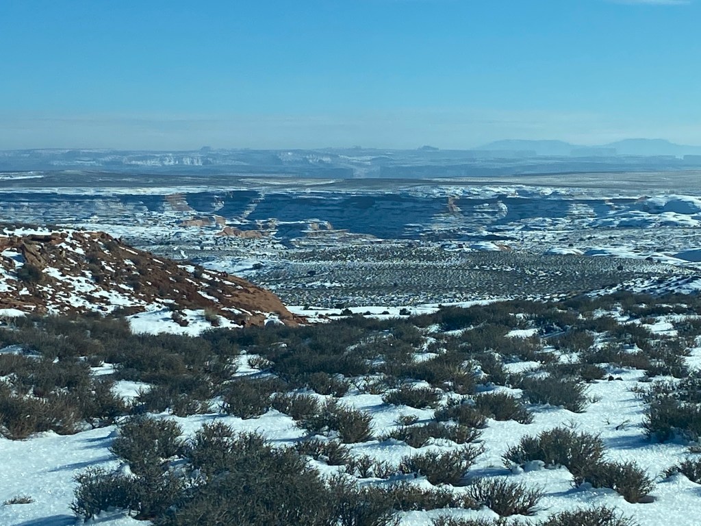
As we drove back past our campsite, the prairie started to open up and reveal some scenery. The canyon was absolutely massive! Breathtaking and unrefined. I couldn’t wait to get back out of the car and see everything involved in this hike to Colonnade arch
We had the coordinates for the arch in the GPS again, because it was said to be somewhat off grid. There were trails and cairns around but as they were covered in snow, it wasn’t exactly direct. This is another place where there are no signs.

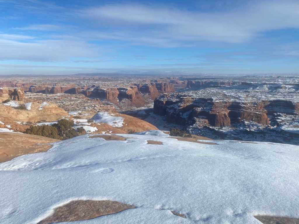
Once we started hiking down into the canyon, there were some steep rock faces, with routes that snaked over the tops of sloped rock cliffs, and some un-clear/un-marked dead ends. When we got to the edge of the canyon rim, where it dropped down about 1,000 feet in front of us, Shannon pointed in a direction that from where we stood, seemed impassable. It was the route to Colonnade arch and we had to figure out how to get there. It was, without question, a dangerous spot. First of all, it was a ledge, about 20 feet wide. It was sloped at about a 25 degree angle and covered in ice. Any slip and fall would take you right over that cliff to a 1,000 foot drop. There were no safety ropes or handrails.
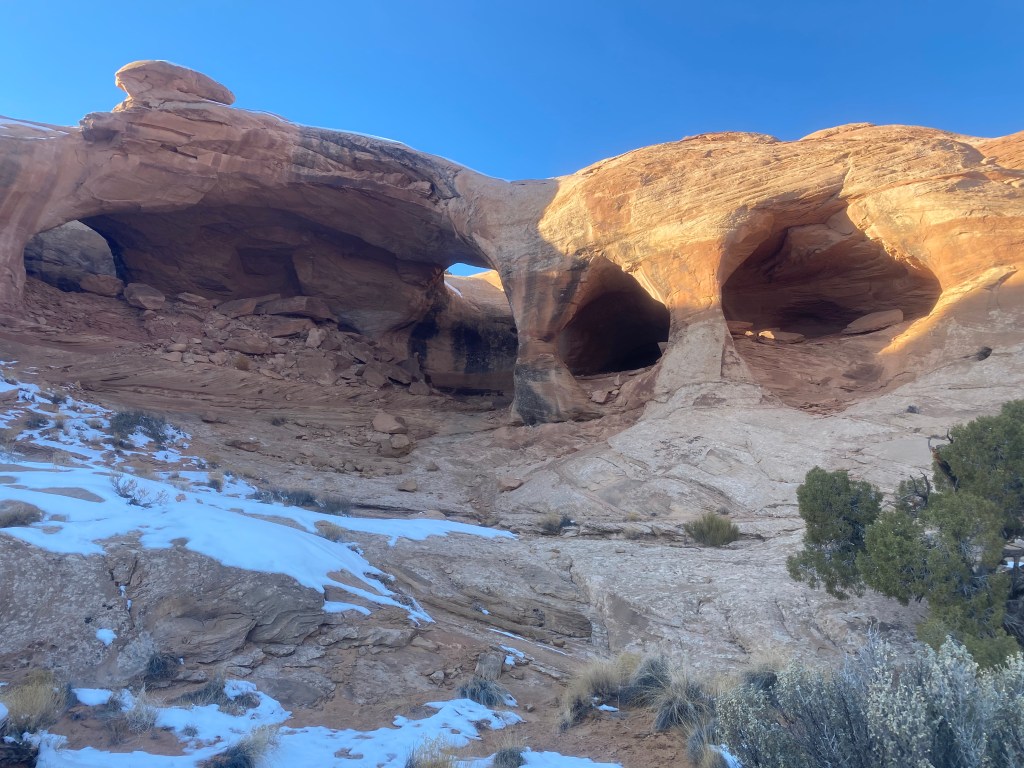
After a serious discussion about safety, with exact directions about where to step, what to hold on to, and what not to do, I felt prepared enough. We crossed the ledge one at a time in a highly stressful, tense, sweaty-palmed pass. Once across, we could look up behind us to see it.


Side note- when we came back and floated the Green river in May, Shannon had the Colonnade arch location marked on a map and in the GPS. When we were floating past, we were able to look up and locate Colonnade arch through binoculars from below. We both saw it and it was one of our favorite moments!

Colonnade arch has a cave like appearance with an unbelievable view. It’s an all natural structure, not associated with any known Native American history. It’s hard to imagine that it wasn’t used as a dwelling. Except perhaps for the lack of a safe route to access it- especially in January.
Once we were ready to head back, we had another highly stressful, careful, directed yet safe trek across the sloped narrow ice covered ledge. The remainder of the hike after that was a piece of cake. According to my “ steps” app we hiked a grand total of 15 miles this day. By the time we got back to camp, we didn’t even bother with a campfire. We got strait into the sleeping bags and sacked out.

The next morning we woke to this incredible sunrise. Impossible to capture in panoramic with an iPhone camera, it encircled our campsite, bathing the snow in bright orange. A nice backdrop to end our stay here, as we packed up and headed to Horseshoe Canyon. I’ll tell you about that next!
